Mt. Brook Partnership- W.F. Major Creek Trib R7

05/11/2009, Attachment #77753, MtBrook_outlet1")
|
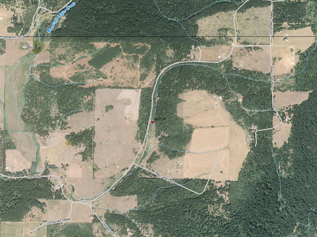
Underwood Conservation Dist; Mt. Brook Partnership- W.F. Major Creek Trib R7 (#08-2125)
05/11/2009, Attachment #77753, MtBrook_outlet1
|
|
|
|
|
This project will remove a set of culverts which have been identified as a fish passage barrier on the West Fork of Major Creek, a Columiba River tributary. The culverts that will be removed are located on the property of Jim Alan (Mt. Brook Partnership) and are a fish passage barrier due to the height of the outfall drop (water surface drop). There are three partial barrier natural falls downstream, one four foot high, one is a coho barrier and one has no data but steelhead are documented above it. Approximatly 0.27 miles of Type F fish habitat and approximately 1.86 miles of habitat with less than 20% gradient are excepted to be opened up by this passage correction. Project partners include Jim Alan, Steve Head, Mt. Brook Partnership, Patrick Powers and Underwood Conservation District.
|
|
General Area:
|
|
Klickitat County
|
|
Waterbody:
|
|
Unnamed, Unnamed Tributary to WF Major Cr, WF Major Cr
|
|
County:
|
|
Klickitat
|
|
Legislative District:
|
|
17
|
|
Congressional District 2022:
|
|
04
|
|
Salmon Recovery Regions:
|
|
Lower Columbia River
|
|
Watershed Administrative Unit:
|
|
Major Creek
|
|
HUC8:
|
|
Middle Columbia-Hood (17070105)
|
|
WRIA:
|
|
Wind - White Salmon
|
|
Sections:
|
|
35
|
|
Township:
|
|
T04NR11E
|
|
Coordinates:
|
|
45.79472065
-121.38767201
|
|
|
Amounts may not be complete
| Worksite Name | | Property Name | Landowner Type |
|
Mt Brook Partnership Fish Barrier (#1)
|
|
Property 1 - Jim Alan
|
Private
|
| | | | Total |
Amounts may not be complete
| | Category / Work Type / Metric | Final |
Restoration Metrics (rolled up from Worksite level) |
Fish Passage Improvement |
| Road-crossing removal (C.2.i.1) |
|
|
Miles of stream made accessible by road crossing removal (C.2.i.3)
|
0.27
|
|
|
Number of road-crossings (C.2.i.2)
|
1
|
| |
|
|
Number of blockages / impediments / barriers impeding passage (C.2.b.4)
|
1
|
| Milestone Name | Target Date | Description |
|
Project Start
|
10/06/2009
|
|
|
30% Design Review/Cost Check
|
03/22/2010
|
|
|
Applied for Permits
|
04/19/2010
|
|
|
Progress Report Due
|
05/17/2010
|
|
|
Bid Awarded/Contractor Hired
|
06/01/2010
|
|
|
Cultural Resources Complete
|
06/16/2010
|
Must comply with Governor's Executive Order 05 - 05 before and ground disturbing activities occur.
|
|
Annual Project Billing Due
|
07/31/2010
|
|
|
Construction Started
|
08/16/2010
|
|
|
Progress Report Due
|
11/30/2010
|
|
|
Progress Report Due
|
05/16/2011
|
|
|
Annual Project Billing Due
|
07/31/2011
|
|
|
Construction Complete
|
08/31/2011
|
|
|
Agreement End Date
|
10/31/2011
|
|
|
Final Docs/Billing to Mgmt Agy
|
11/30/2011
|
|
|
Progress Report Due
|
11/30/2011
|
|